Town Planning Architecture Layout with Urban Street and Zoning Map
Description
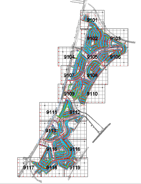
This town planning architecture layout provides a complete urban design framework showcasing detailed street networks, zoning divisions, land allocation grids, and organized development sectors. Each plotted zone is represented with structured numbering and coordinated grid lines, allowing architects and planners to analyze road hierarchy, neighborhood grouping, and block formation. The layout highlights contour-based street patterns, landscape corridors, pedestrian pathways, plot boundaries, and utility corridors required for large-scale urban development. The grid references surrounding the site help planners understand geometric alignment and area distribution for precise infrastructure planning.
The drawing further includes planned access roads, internal circulation routes, future development pockets, and open spaces designed to support balanced land utilization. The pattern of curved and linear streets suggests a mixed urban fabric suitable for residential clusters, commercial pockets, and recreational zones. Utility planning, electrical routes, and primary service alignments are clearly shown, enabling engineers to coordinate urban amenities efficiently. This layout is ideal for architects, urban planners, GIS specialists, civil engineers, and infrastructure consultants involved in designing large community master plans. The detailed zoning arrangement and interconnected road design offer strong guidance for city development, sustainable land planning, and long-term growth modeling.
File Type:
DWG
File Size:
14.9 MB
Category::
Urban Design
Sub Category::
Town Design And Planning
type:
Gold
Uploaded by:
K.H.J
Jani